

Et nytt geografisk og hydrografisk kart over hele verden c1630
“Et nytt geografisk og hydrografisk kart over hele verden” er et kart laget i 1630 av den anerkjente nederlandske kartografen Henricus Hondius II (1597-1651). Dette mesterverket eksemplifiserer det intrikate kunstnerskapet til kartografi fra 1600-tallet og er et sentralt eksempel på gullalderen for nederlandsk kartlaging. Kartet er svært detaljert, dekorativt verdenskart, viser ikke bare geografisk kunnskap, men også den sofistikerte blandingen av vitenskapelig oppdagelse og kunstnerisk estetikk som dominerte perioden. Hondius, en fremtredende skikkelse i kartverdenen, var kjent for sin ekspertise innen gravering og kartpublisering, og dette stykket gjenspeiler talentene hans perfekt.
Innholdsfortegnelse
Hovedfag og komposisjon
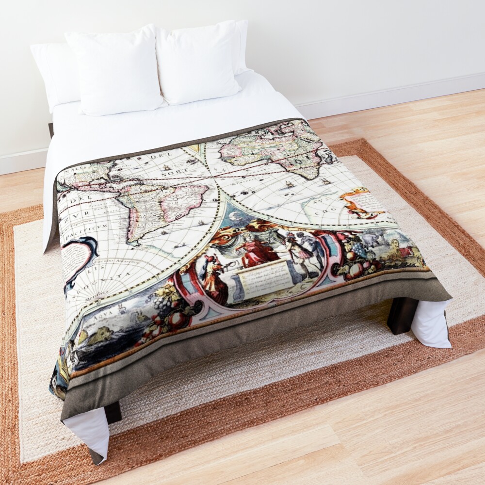
I hjertet av dette kartet er skildringen av verden, delt i to halvkuler. The left hemisphere represents the Americas, while the right hemisphere shows Europe, Asia, and Africa. Each continent is meticulously detailed, with recognizable features such as coastlines, rivers, mountain ranges, and other geographical landmarks. Hondius’ map features the classic stylized cartography of the time, combining both geographical accuracy and ornate decoration.
The use of the two hemispheres creates a balanced composition, with an eye-catching central division. Surrounding the map’s cartographic elements are intricate, allegorical figures and symbolic imagery that elevate the map beyond mere geography. Hondius combines the representation of the Earth’s continents with thematic artistry, incorporating historical and mythological motifs that provide a visual narrative of exploration, oppdagelse, and imperial ambition.
Dekorative elementer
The map’s margins are adorned with elaborate borders filled with mythological figures, classical representations, and a nod to the burgeoning age of scientific exploration. To store, circular portraits of famous figures from the classical world – one of a Roman emperor and the other of a skull, possibly referencing the inevitability of death and the limits of human ambition – appear at the top corners. These portraits are framed by colorful, swirling designs and surrounded by more emblematic imagery, such as cherubs, dyr, and fantastical creatures, which are used to convey the interconnectedness of human progress with the natural world.
The bottom corners of the map are also embellished with the figures of historical characters: one depicts a regal, seated woman representing the New World, mens den andre har en gruppe oppdagere, kanskje symboliserer den europeiske utvidelsen av makt og kunnskap over hele kloden. Disse figurene forsterker kartets tema for global utforskning, som gjenspeiler tidens keiserlige ambisjoner, samtidig som den tilfører et humanistisk element som gjenspeiler tidens kunst.
Materialer og teknikker
Henricus Hondius brukte kobberstikk for å produsere dette kartet, en teknikk som muliggjorde fine detaljer og slitesterkt trykk. Kartets farger er rike og levende, med håndfarging påført etter utskriftsprosessen. Fargingen tjener ikke bare til å skille geografiske regioner, men det legger også til et lag av visuell kompleksitet og lokke. Bruken av lyse, men likevel balanserte grønnfarger, blå, og rødt skaper en visuell dybde som trekker betrakterens øye over kartets overflate, inviting them to explore the details of each region.
The materials used in the creation of this work, paper, ink, and copper engraving, demonstrate the precision and technical prowess of the time. The engraved lines and the application of color emphasize the decorative nature of the map while still preserving its primary function as a geographical tool.
Stil og tema
Stilen til “Et nytt geografisk og hydrografisk kart over hele verden” is deeply rooted in the Baroque period, where the combination of artistic flourish and intellectual exploration defined the visual culture. The cartographic style is representative of the time, with highly stylized illustrations, exaggerated shapes for landmasses, and a tendency to embellish rather than to focus on strict accuracy.
The map also integrates elements of the Enlightenment spirit, though it predates the full bloom of the movement. The thematic focus of exploration and the desire to understand the world are central to the mood of the piece. The artwork presents a world in flux, one that is still being explored, with many unknowns yet to be discovered. This exploration theme is reinforced by the inclusion of classical imagery, alluding to the timeless quest for knowledge, expansion, and discovery.
Stemning og emosjonell påvirkning
The overall mood of the artwork is one of grandeur and optimism, reflective of the 17th century’s fascination with global exploration and the assertion of European power. The map is not just a scientific tool but an artistic expression of a world ripe for discovery. The use of allegory and classical motifs imbues the map with a sense of nobility and the promise of an enlightened future, even as it acknowledges the dark undercurrents of exploration, such as conquest and colonialism.
There is also an element of wonder in the map, an emotional undercurrent that speaks to the awe inspired by the vastness of the world and the curiosity that drives human exploration. The combination of cartographic knowledge with ornate decoration elevates the map into a work of art, capturing both the intellectual and emotional dimensions of the period.
Konklusjon
“Et nytt geografisk og hydrografisk kart over hele verden” by Henricus Hondius II stands as a testament to the art and science of early 17th-century map-making. Through intricate detail, expert craftsmanship, and a rich combination of symbolism and cartographic precision, Hondius creates not just a geographical map, but a work of art that captures the spirit of exploration and the intellectual curiosity of the era. The decorative elements, the allegorical representations, and the overall composition of the piece invite viewers to reflect on the human journey of discovery, while also celebrating the intricate beauty of the world as it was known in the 1600s.
Artwork Backstory
Nytt geografisk og hydrografisk verdenskart c1630 av den nederlandske kartografen Henricus Hondius II (1597 – 1651); samt en gravør og forlegger.
En vakker klassisk kunst verdenskart fra 1600-tallet, når kartlaging ikke bare var teknisk, men kunstnerisk så vel som å blande inn klassiske temaer og begivenheter sammen med det som var kjent om verden på 1600-tallet.
Dette retusjerte bildet av Nova Totius verdenskart ble laget av Hendrik Hondius II i 1630, og publisert året etter i Atlas Atlantis Maioris Appendix.
Det er kjent som det første daterte kartet som ble publisert i et atlas, som gjorde det allment tilgjengelig, så vel som det andre kartet for å vise hvilken som helst del av Australia; det første kartet som gjorde det var Caert van't Landt van d'Eendracht (“Kart over Land of Concord”), laget av Hessel Gerritsz’ i 1627 som ikke fikk stor utbredelse.
Kartet viser også den australske kystlinjen som en del av vestkysten av Cape York-halvøya, som ble oppdaget av Jan Carstensz i 1623; men viser ikke vestkysttrekkene som er vist i Gerritsz’ kart, Caert van't Landt van d'Eendracht.
Dette er en remastret digital kunst-gamle mesterreproduksjon av et offentlig domenebilde som er tilgjengelig som en lerretstrykk online.