

Nova Totius Terrarum Orbis Geographica ac Hydrographica Tabula c1630
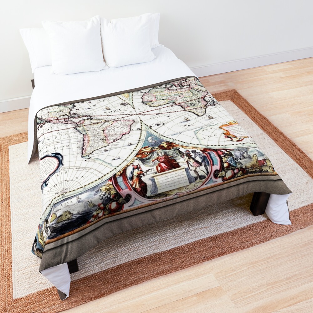
“Nova Totius Terrarum Orbis Geographica ac Hydrographica Tabula” is a map created in 1630 by the renowned Dutch cartographer Henricus Hondius II (1597-1651). This masterpiece exemplifies the intricate artistry of 17th-century cartography and is a key example of the golden age of Dutch map-making. The map is a highly detailed, decorative world map, showcasing not just geographical knowledge but also the sophisticated blend of scientific discovery and artistic aesthetics that dominated the period. Hondius, a prominent figure in the world of maps, was known for his expertise in engraving and map publishing, and this piece reflects his talents perfectly.
Оглавление
Основная тема и композиция
At the heart of this map is the depiction of the world, separated into two hemispheres. The left hemisphere represents the Americas, while the right hemisphere shows Europe, Asia, and Africa. Each continent is meticulously detailed, with recognizable features such as coastlines, rivers, mountain ranges, and other geographical landmarks. Hondius’ map features the classic stylized cartography of the time, combining both geographical accuracy and ornate decoration.
The use of the two hemispheres creates a balanced composition, with an eye-catching central division. Surrounding the map’s cartographic elements are intricate, allegorical figures and symbolic imagery that elevate the map beyond mere geography. Hondius combines the representation of the Earth’s continents with thematic artistry, incorporating historical and mythological motifs that provide a visual narrative of exploration, discovery, and imperial ambition.
Decorative Elements
The map’s margins are adorned with elaborate borders filled with mythological figures, classical representations, and a nod to the burgeoning age of scientific exploration. Two large, circular portraits of famous figures from the classical world – one of a Roman emperor and the other of a skull, possibly referencing the inevitability of death and the limits of human ambition – appear at the top corners. These portraits are framed by colorful, swirling designs and surrounded by more emblematic imagery, such as cherubs, животные, and fantastical creatures, which are used to convey the interconnectedness of human progress with the natural world.
The bottom corners of the map are also embellished with the figures of historical characters: one depicts a regal, seated woman representing the New World, while the other features a group of explorers, perhaps symbolizing the European expansion of power and knowledge across the globe. These figures enhance the map’s theme of global exploration, echoing the imperial ambitions of the time, while also adding a humanistic element that reflects the art of the era.
Материалы и методы
Henricus Hondius used copperplate engraving to produce this map, a technique that allowed for fine details and durable printing. The map’s colors are rich and vibrant, with hand-coloring applied after the printing process. The coloring not only serves to distinguish geographical regions, but it also adds a layer of visual complexity and allure. The use of bright, yet balanced hues of green, синий, and red creates a visual depth that pulls the viewer’s eye across the map’s surface, inviting them to explore the details of each region.
The materials used in the creation of this work, бумага, ink, and copper engraving, demonstrate the precision and technical prowess of the time. The engraved lines and the application of color emphasize the decorative nature of the map while still preserving its primary function as a geographical tool.
Стиль и тема
Стиль “Nova Totius Terrarum Orbis Geographica ac Hydrographica Tabula” is deeply rooted in the Baroque period, where the combination of artistic flourish and intellectual exploration defined the visual culture. The cartographic style is representative of the time, with highly stylized illustrations, exaggerated shapes for landmasses, and a tendency to embellish rather than to focus on strict accuracy.
The map also integrates elements of the Enlightenment spirit, though it predates the full bloom of the movement. The thematic focus of exploration and the desire to understand the world are central to the mood of the piece. The artwork presents a world in flux, one that is still being explored, with many unknowns yet to be discovered. This exploration theme is reinforced by the inclusion of classical imagery, alluding to the timeless quest for knowledge, расширение, and discovery.
Настроение и эмоциональное воздействие
The overall mood of the artwork is one of grandeur and optimism, reflective of the 17th century’s fascination with global exploration and the assertion of European power. The map is not just a scientific tool but an artistic expression of a world ripe for discovery. The use of allegory and classical motifs imbues the map with a sense of nobility and the promise of an enlightened future, even as it acknowledges the dark undercurrents of exploration, such as conquest and colonialism.
There is also an element of wonder in the map, an emotional undercurrent that speaks to the awe inspired by the vastness of the world and the curiosity that drives human exploration. The combination of cartographic knowledge with ornate decoration elevates the map into a work of art, capturing both the intellectual and emotional dimensions of the period.
Заключение
“Nova Totius Terrarum Orbis Geographica ac Hydrographica Tabula” by Henricus Hondius II stands as a testament to the art and science of early 17th-century map-making. Through intricate detail, expert craftsmanship, and a rich combination of symbolism and cartographic precision, Hondius creates not just a geographical map, but a work of art that captures the spirit of exploration and the intellectual curiosity of the era. The decorative elements, the allegorical representations, and the overall composition of the piece invite viewers to reflect on the human journey of discovery, while also celebrating the intricate beauty of the world as it was known in the 1600s.
Предыстория произведения искусства
Новая географическая и гидрографическая карта мира 1630 года, составленная голландским картографом Хенрикусом Хондиусом II. (1597 – 1651); а также гравер и издатель.
красивый классическое искусство карта мира 1600-х годов, когда создание карт было не только техническим, но также художественное смешение классических тем и событий с тем, что было известно миру еще в 1600-х годах..
Это отретушированное изображение карты мира Новой Тотиус было создано Хендриком Хондиусом II в 1630, и опубликован в следующем году в приложении Atlas Atlantis Maioris..
Это примечательно тем, что это первая датированная карта, опубликованная в атласе., что сделало ее широко доступной, а также вторую карту, показывающую любую часть Австралии.; первой картой, на которой это было сделано, была Caert van't Landt van d'Eendracht. (“Карта Земли Согласия”), создано Хесселем Герритцем’ в 1627 который не получил широкого распространения.
На карте также показано побережье Австралии как часть западного побережья полуострова Кейп-Йорк., который был обнаружен Яном Карстензом в 1623; но не показывает особенности западного побережья, которые показаны в Gerritsz’ карта, Каерт ван’т Ландт ван д’Эендрахт.
Это обновленная цифровая репродукция старых мастеров изображения, являющегося общественным достоянием, которое доступно в качестве Все эти ремастерированные изображения старых мастеров цифрового искусства, являющиеся общественным достоянием, доступны как.